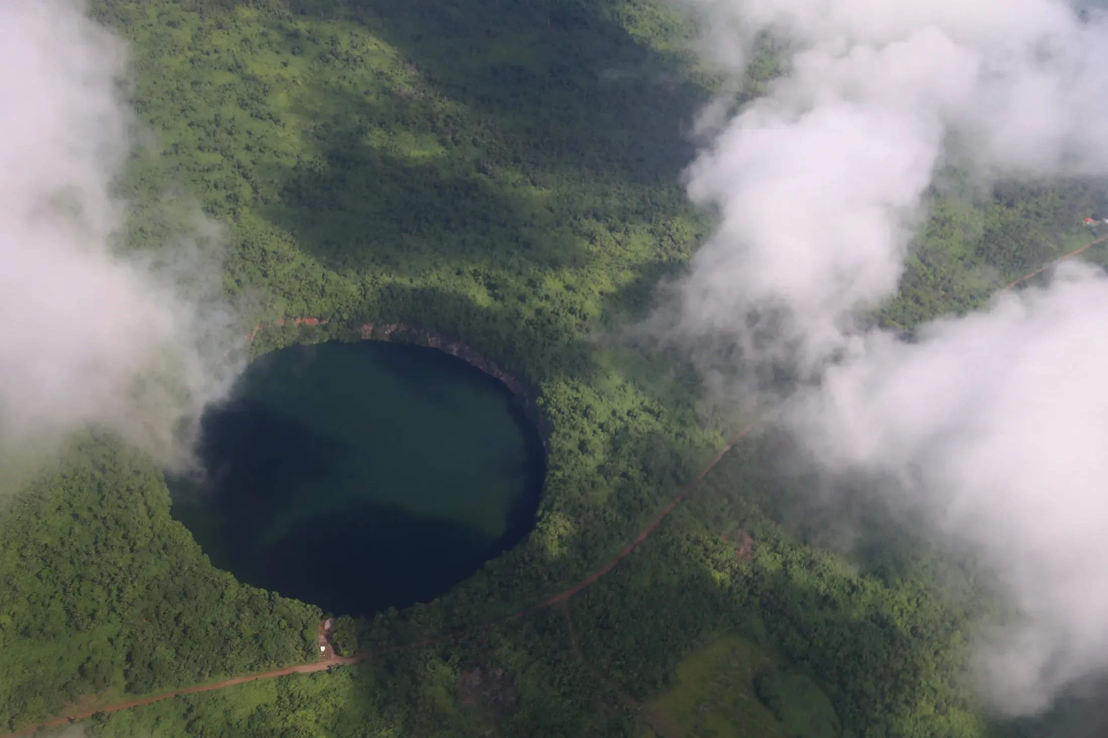
Lake Lalolalo is the largest lake in the territory, a nearly circular crater lake in the southwest of Wallis, roughly 400-500 m across and at least 80 m deep, with sheer rock walls. A lookout gives a view of the whole lake, which lies off Route 1 between Mala'etoli and Ahoa.
Things to do ·
Lake Lalolalo, Wallis: depth, history and how to visit
Lake Lalolalo is a crater lake on Wallis, 400-500 m across and at least 80 m deep. What it is, the history, the lookout and how to visit respectfully.
01
What Lake Lalolalo is
Lake Lalolalo (in French, lac Lalolalo) is one of several crater lakes on Wallis, formed by volcanic activity in the mid-Pleistocene. Others include Lanutavake, Kikila and Alofivai. Of the lakes listed for the territory it is the largest, at 15.2 hectares.
The official territory site calls it one of the largest inland crater lakes in the Pacific region. The crater is nearly circular, with sheer rock walls falling to the water, and rainforest on the rim.

02
How deep is it?
Published figures vary, so we use the cautious one: at least 80 m deep and roughly 400-500 m across. A University of Washington field page from a 2011 research visit gives larger numbers, but the measurement method is not stated, so we do not quote them.
The lake is also unusual in its layers. It is stratified, fresh at the surface and about 31 parts per thousand salinity at the bottom, with no oxygen below 10 m. The 2011 team reported that water brought up from 80 m depth fizzed like a fizzy drink and smelled of hydrogen sulfide, and blind white eels were reported.
03
Where it is and how to get there
Lalolalo lies in the southwest of Wallis, off Route 1 between Mala'etoli and Ahoa. A lookout gives a view of the whole lake. It is part of the board's southern route, alongside the Talietumu fort site at Kolonui.
There is no public transport and no taxis on the islands, so you need a hire car. The Lausikula Guesthouse, in the south, is listed about 4.3 km from the lake, which makes it a handy base. Confirm rates and availability directly, since the listings are undated.
04
History, myth and the war years
The lake figures in local mythology and in historical territorial disputes. Both matter when you visit: this is a place with meaning, not just a view.
During the Second World War, a road was cut through the forest around the lake that is regarded as sacred, vao tapu, and the US Army later disposed of equipment and ammunition in several lakes, notably Lalolalo. You will find other rumours online. We have left out the ones we cannot source.

05
Wildlife around the rim
Flying foxes and tropical birds live in the forest around the lake. The crater lakes are also freshwater reserves for the island, so treat the area quietly and leave nothing behind.
Wallis has other lakes. Lake Kikila is another of the crater lakes, and the tourism board names three crater lakes on Wallis: Lanutavake, Lano and Lalolalo.

06
Swimming, safety and etiquette
Searches for Lalolalo swimming are common. We have found no official statement that swimming is allowed, and given the depth, the oxygen-free layers and the cliffs we would not treat it as a swimming spot. Ask locally before you consider anything beyond the lookout.
We have not confirmed what barriers, if any, exist at the lookout, so keep back from cliff edges, and take children firmly by the hand.
Respect the land. Check that any site you visit is not private, and ask before you photograph people. Wear sturdy shoes and bring water.
07
Pairing Lalolalo with the rest of the south
The board's southern route puts the lake together with the chapel at Lausikula, the Kolonui fort and the church at Mala'efo'ou, with lunch at a snack bar. Our guide to how many days to stay shows where it fits in a longer trip.
Questions people ask.
- How deep is Lake Lalolalo?
- At least 80 m. Sources give different figures, so we say at least 80 m and roughly 400-500 m across rather than a single precise number.
- Where is Lake Lalolalo?
- In the southwest of Wallis, off Route 1 between Mala'etoli and Ahoa. A lookout gives a view of the whole lake.
- Can you swim in Lake Lalolalo?
- We have found no official guidance that swimming is permitted, and the lake is very deep with no oxygen below 10 m. Treat it as a viewpoint and ask local people before doing anything else.
- Is Lake Lalolalo connected with the sea?
- Our records do not say. They do show that the lake is fresh at the surface and about 31 parts per thousand salinity at the bottom.
- Why is the forest around Lalolalo important?
- It is regarded as sacred (vao tapu), and the lake figures in local mythology. A road was cut through that forest in the Second World War.
Stay on the islands with IMPT.
IMPT (impt.io) is the booking platform behind this site: 8 million hotels and apartments across 195 countries, including the Pacific neighbours of Wallis & Futuna. Stays on Wallis and Futuna themselves are arranged by enquiry with each host. Every stay booked through IMPT supports climate action through the IMPT Climate Contribution programme.
Read next.
The invitation starts here
Be part of the
next chapter.
Join the waitlist First access to stays, routes and launch news.
No spam. Unsubscribe any time.